Browsing by Subject "ORDENACION DE TIERRAS"
Now showing items 1-20 of 22
-
Análisis de la vulnerabilidad al cambio climático de bosques de montaña en Latinoamérica: un punto de partida para su gestión adaptativa
(Centro Agronómico Tropical de Investigación y Enseñanza (CATIE), 2016)Este documento es una herramienta para el análisis de la vulnerabilidad al cambio climático de bosques en cordilleras y la aplicó en cinco territorios de Latinoamérica, en condiciones tropicales (Honduras, Colombia y Costa ... -
Análisis multitemporal de cambio de uso del suelo y dinámica del paisaje en el Corredor Biológico Volcánica Central Talamanca, Costa Rica
(CATIE, Turrialba (Costa Rica), 2009)A partir de imágenes de satélite y fotografías aéreas, se crearon mapas de uso del suelo en el Corredor Biológico Volcánica Central Talamanca (CBVCT) para los años 1986, 1996, 2001 y 2008, dichos mapas fueron sometidos a ... -
Análisis participativo de las condiciones actuales para la implementación del plan de ordenamiento territorial de la microcuenca del Río Sesesmiles, Honduras
(Centro Agronómico Tropical de Investigación y Enseñanza (CATIE), 2008)Se realizó el análisis de las condiciones para la implementación del Plan de Ordenamiento Territorial (POT) para la microcuenca del río Sesesmiles en Copán, Honduras con la participación de los actores locales de las ... -
Dinámica del uso de la tierra y de la oferta hídrica en la cuenca del río Guacerique, Tegucigalpa, Honduras
(CATIE, Turrialba (Costa Rica), 2003)Los cambios multitemporales del uso de la tierra y la respuesta cuantitativa de la oferta de agua en la cuenca del río Guacerique fueron analizados. Un enfoque metodológico para el ordenamiento territorial se propone, ... -
Dinámica, uso apropiado y sostenible de la tierra, en la Cuenca del Río Turrialba
(CATIE, Turrialba (Costa Rica), 1993)La Cuenca del Río Turrialba, abarca una superficie de 7451,10 ha. y es donde se concentra gran parte de la población del cantón de Turrialba, siendo también un punto importante en cuanto al desarrollo económico de la zona, ... -
Directrices de gestión ambiental para las cuencas costero marinas de la Bahía de Amatique, Caribe de Guatemala
(CATIE, Turrialba (Costa Rica), 2003)Se definieron las directrices de gestión ambiental para las cuencas costero marinas de la bahía de Amatique en el Caribe de Guatemala. Con base en la caracterización de la zona costero marina se formularon categorías de ... -
Ecosystem biodiversity in lowland tropical rain forests of Central America: characterisation and applications to land management
(CATIE, 1999)El nivel de ecosistemas es importante en la medición de biodiversidad y en la planificación tanto para la conservación, como para el manejo forestal. No obstante, estudios sistemáticos de la biodiversidad de ecosistemas ... -
Evaluation and planning of the sustainable forest management in landscape level in Hojancha, Costa Rica
(CATIE, Turrialba (Costa Rica), 2005)El objetivo general de esta investigación fue contribuir a la planificación integral de la Producción forestal sostenible y de la conservación ambiental en escala de paisaje en el cantón de Hojancha. Para esto se levantó ... -
Herramientas de gestión territorial y su potencialidad para promover medios de vida sostenibles como estrategia de conservación y desarrollo local
(CATIE, Turrialba (Costa Rica), 2016)Lograr que los paisajes manejados permitan la continuidad paisajística entre áreas boscosas, es una de las premisas para la conservación de la biodiversidad y significa un reto que incluye a las comunidades que habitan los ... -
III Curso internacional de liderazgo para el desarrollo de la ecoagricultura con enfoque territorial para Centroamérica. Memoria
(CATIE, Turrialba (Costa Rica), 2010) -
Instrumento para la gestión y manejo del territorio con enfoque en la resiliencia socio-ecológica para la construcción de paz territorial en las microcuencas El Hatillo y Cebadero, municipio de Albán, Nariño, Colombia
(CATIE, Turrialba (Costa Rica), 2018)La investigación buscó el desarrollo de un instrumento de gestión y ordenamiento del territorio, bajo el enfoque de resiliencia socio ecológica, que aporte en la construcción de paz en los territorios; el estudio se ... -
[Memorias del seminario]
(Proyecto de Desarrollo Rural Integral Peninsular, San José (Costa Rica), 2001) -
Modelación del uso de la tierra para orientar el desarrollo territorial en la subcuenca del río Copán, Honduras
(CATIE, Turrialba (Costa Rica), 2004-03)El estudio consistió en modelar el uso de la tierra en la subcuenca del río Copán, occidente de Honduras, por medio de programación lineal y sistemas de información geográfica. Se elaboró un modelo que integró variables ... -
Modelación del uso de la tierra para orientar el ordenamiento territorial en la sub-cuenca del río Copán, Honduras
(CATIE, Turrialba (Costa Rica), 2002)El presente estudio consistió en la modelación del uso de la tierra en la sub-cuenca del Río Copán, zona occidente de Honduras. Se utilizó programación lineal y sistemas de información geográfica para la elaboración de un ... -
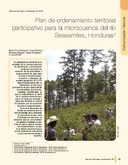
Participative territorial ordening plan for the microwatershed of the Sesesmiles river, Honduras
(CATIE, Turrialba (Costa Rica), 2008)it consists of seven strategic axes: forest development, agricultural development, hydrological protection, conservation, risks managing, urban development and road infrastructure. 24 development projects are proposed to ... -
Plan de ordenamiento territorial de la subcuenca del río Jucuapa, Matagalpa, Nicaragua
(CATIE, Turrialba (Costa Rica), 2008)luego un análisis prospectivo iniciando como el modelo territorial, el escenario tendencial, así como el modelo territorial futuro sometido a consenso en talleres de consulta, como base para la formulación del POT con su ... -
Plan de ordenamiento territorial participativo para la gestión de zonas potenciales de recarga hídrica en la microregión hidrográfica Balalaica, Turrialba, Costa Rica
(CATIE, Turrialba (Costa Rica), 2008)Se elaboró el plan de ordenamiento territorial participativo (POTP) para la gestión de zonas potenciales de recarga hídrica en la microregión hidrográfica Balalaica, en Turrialba, Costa Rica. Este estudio fue realizado con ... -
Plan de ordenamiento territorial participativo para la microcuenca del Río Sesesmiles, Honduras
(CATIE, Turrialba (Costa Rica), 2008)It consists of seven strategic axes: forest development, agricultural development, hydrological protection, conservation, risks managing, urban development and road infrastructure. 24 development projects are proposed to ... -
Principios, criterios e indicadores para la evaluación de corredores biológicos y su aplicación: caso Costa Rica
(CATIE, Turrialba (Costa Rica), 2002-04)Los corredores biológicos han despertado mucho interés en varias regiones y países. Sin embargo, los criterios para su establecimiento todavía no están claramente definidos y en la práctica no siempre enfatizan su principal ...