| dc.contributor.author | Méndez, E. | |
| dc.contributor.author | Piedra, M. | |
| dc.contributor.author | González, A. | |
| dc.contributor.author | Jones, J. | |
| dc.date.accessioned | 2015-03-19T20:55:56Z | |
| dc.date.available | 2015-03-19T20:55:56Z | |
| dc.date.issued | 2004-11 | |
| dc.identifier | 466788 | es_ES |
| dc.identifier.issn | e-ISSN: 1659-1216 | es_ES |
| dc.identifier.uri | https://repositorio.catie.ac.cr/handle/11554/5777 | |
| dc.description.abstract | Mediante un análisis espacial, el estudio buscaba identificar los factores físicos, naturales y socioeconómicos que influyen en el uso del suelo de la cuenca del río Turrialba. Con la ayuda del Sistema de Información Geográfica como herramienta para la elaboración de la base de datos, los diferentes usos de suelo se agruparon en seis categorías (bosque, pasto, café, caña, urbano y otros); como insumos se usaron fotografías e imágenes de satélite. A partir de modelos de regresión logística multinomial, los resultados demostraron que el uso del suelo en la cuenca del río Turrialba se explica por una combinación de los factores profundidad de suelo, tipo de suelo, zonas de vida, tamaño de finca y distancia como costo de acceso, la cual incluye un coeficiente de fricción a partir del mapa de pendientes. Los resultados demostraron que la fotografía aérea tiene un 67% de eficiencia en la predicción de cambios de uso de la tierra, y la imagen de satélite un 61%. No obstante, estos resultados no pueden generalizarse por la agregación de los usos del suelo en seis categorías para fines de comparación. | es_ES |
| dc.description.abstract | By means of a space analysis, the study pretended to identify the natural, physical and socioeconomic factors that have influences on land use in the Turrialba River watershed. The Geographic Information System was used to categorize soil use into six classes: forest, pasture, coffee, sugar cane, urban and others. Two sources of information were used: aerial photographs and satellite images. The data were analyzed through logistical regressions of the type ‘Multinomial Logit’, using the LIMDEP econometric software. The results demonstrated that the land use at the Turrialba river watershed depends on a combination of factors, such as: soil depth, soil type, life zone, size of farm, and distance as access cost. Basing on the slope map, a coefficient of friction was included. The results demonstrated that the aerial photographs rendered an efficiency of 67% in the prediction of land use changes, and 61% the satellite images. These results cannot be generalized since data were manipulated to group uses into six categories, for comparison purposes. Additional studies should be carried out to validate the results. | |
| dc.format.extent | 7 páginas | |
| dc.language.iso | es | es_ES |
| dc.publisher | CATIE, Turrialba (Costa Rica) | es_ES |
| dc.relation.ispartof | Recursos Naturales y Ambiente Número 43 (Noviembre 2004), páginas 118-124 | es_ES |
| dc.rights | info:eu-repo/semantics/openAccess | |
| dc.subject | CUENCAS HIDROGRAFICAS | es_ES |
| dc.subject | UTILIZACION DE LA TIERRA | |
| dc.subject | ORDENACION DE CUENCAS CA | |
| dc.subject | SISTEMAS DE INFORMACION | |
| dc.subject | GEOGRAFICA | |
| dc.subject | FOTOGRAFIA | |
| dc.subject | RECONOCIMIENTO AEREO | |
| dc.subject | IMAGENES SATELITES | |
| dc.subject | COSTA RICA | |
| dc.subject | METODOS ESTADISTICOS | |
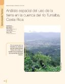
| dc.title | Análisis espacial del uso de la tierra en la cuenca del río Turrialba, Costa Rica | es_ES |
| dc.title.alternative | Space analysis of the land use in the
watershed of the river Turrialba, Costa Rica | |
| dc.type | Artículo | es_ES |


